North in the Spring #11
Fort St James and the Stuart Chain of Lakes by John Neville Heading west from Prince George on Highway #16, the Yellowhead, we passed through Vanderhoof, which boasts of its central position in the province. Interestingly, it is also on the same longitude as Ladysmith on Vancouver Island. This is because the North American landmass expands significantly to the northwest. 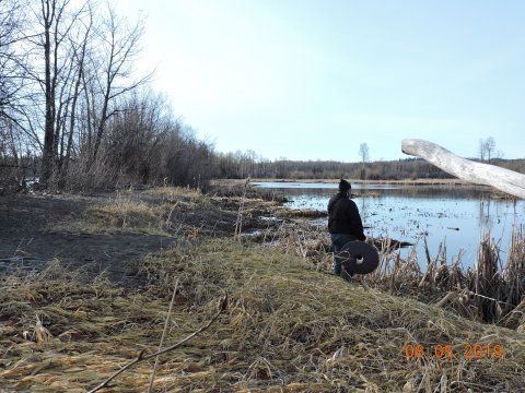 About 4 km past Vanderhoof we turned north on Hwy # 27 towards Fort Saint James.
We soon crossed the Nechako River flowing east to wards Vanderhoof then into the Fraser River at Prince George. We then ascended to the Babine-Stuart Plateau. This rolling upland plateau was created by the ice age, with its wide valleys, large elongated lakes, slow moving rivers and wetlands. Its elevation is between 700 and 1700 meters above sea level. It is a little cooler and wetter than the Nechako Plateau just to the south. The Plateau is covered by a forest of White and Engelmann Spruce, Subalpine Fir, Lodgepole Pine and significant areas of Aspen and Paper Birch. The sphagnum bogs, marshes and sedge fens are rich habitats for a variety of water fowl. Moose, bear, deer and smaller mammals are found in the area. Salmon spawn in the Stuart River. Lake Trout, Rainbow Trout, Arctic Char, Kokane, Burbot and Mountain Whitefish are also found in this lake system.
About 4 km past Vanderhoof we turned north on Hwy # 27 towards Fort Saint James.
We soon crossed the Nechako River flowing east to wards Vanderhoof then into the Fraser River at Prince George. We then ascended to the Babine-Stuart Plateau. This rolling upland plateau was created by the ice age, with its wide valleys, large elongated lakes, slow moving rivers and wetlands. Its elevation is between 700 and 1700 meters above sea level. It is a little cooler and wetter than the Nechako Plateau just to the south. The Plateau is covered by a forest of White and Engelmann Spruce, Subalpine Fir, Lodgepole Pine and significant areas of Aspen and Paper Birch. The sphagnum bogs, marshes and sedge fens are rich habitats for a variety of water fowl. Moose, bear, deer and smaller mammals are found in the area. Salmon spawn in the Stuart River. Lake Trout, Rainbow Trout, Arctic Char, Kokane, Burbot and Mountain Whitefish are also found in this lake system.
 In 1805 Simon Fraser and John Stuart explored the Nechako and Stuart Rivers. The Stuart has some class 3 and 4 rapids so they must have been very tough and quite determined to find more places to trade for furs. Where Stuart Lake flows into the Stuart River they found a thriving community of First Nations people. The general name for people of this area is Daka "the people who travel on water". The Europeans soon started to call them Carrier People. There are two theories for this name: first, widowed people carried the ashes of their husbands on their back for one year. The second reason is that they were strong and could carry heavy loads.
Stuart and Fraser established a trading post in 1806 which became Fort St James. Today Parks Canada runs the Fort St. James Historic Park. They didn't realize that the settlement was already an important trading center for the local people. For example, the eulachon or candlefish trade was conducted with salmon, furs and obsidian. Hudson Bay traders later learnt from the Daka to cross Stuart Lake, portage to Babine Lake, and travel via Hazelton down the Skeena River system. One of the elders at Hazelton explained this route to me in detail. 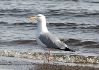 Stuart, Trembleur, Takla lake system is located in the north central part of the province. It comprises about 300 km of water ways. These lakes are also the destination of Chinook and Sockeye Salmon on their longest migration route. There are hundreds of km of natural beaches for boaters to explore. The Middle River drains Takla Lake into Trembleur Lake, the Takla River drains Trembleur Lake into Stuart Lake, and the Stuart River drains all three lakes into the Nechako River. The three rivers do not freeze in winter and provide the most northerly winter habitat for 500+ Trumpeter Swans and other water fowl. It is known as the Stuart-Takla Important Bird Area.
May 7th is International Dawn Chorus day which found us camped on the south shore of Stuart Lake at Paarens Beach. At 4 AM that clear morning Robin, Ruby-crowned Kinglet and Black-capped Chickadee were all singing with the first glimmers of light. 15 minutes later Ruffed Grouse and Hairy Woodpecker started to drum and a Common Loon gave his yodel calls. More birds soon joined in, American Crows, Herring Gull and a pair of Merlin were screaming! From an adjacent marsh Wilson's Snipe were whinnying over their territories; Song Sparrow began to sing; Wigeon flew out to the lake and a Greater Yellowlegs gave his noisy alarms when I approached. When the sun was fully up the many Red-wing Blackbirds began to whistle. At 8 AM Bald Eagle, flocks of Common Merganser and Goldeneye were still silent. The next day we drove around the north-shore of Stuart Lake along Pinchi Road. Where the Tachie River flows into the lake, we admired large flocks of Boneparte Gull, Red-neck grebe and a few Western Grebe. Later we camped on Leo Creek Forest Service Road, where I recorded Varied Thrush, Ruby-crowned Kinglet (which are everywhere), and listened to distant Coyote.  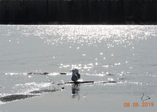 
|