North in the Spring #18:
Granisle Loop. by John Neville
About 20 km east of Houston, we turned off Hwy 16 onto Hwy 118 North. We wanted to explore the route that the tourist brochures call the Granisle Loop. The road steadily ascended to the Babine-Stuart Plateau through a forest of White Pine and Engelmann Spruce. We camped on a forestry service road for a night, with just a light breeze in the aspens. I heard four bird species and the whistled refrains of a White-throated Sparrow for the first time this year!
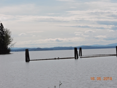
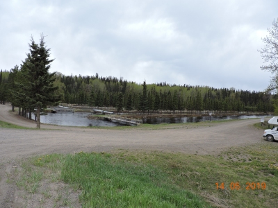 The next morning we visited the Fulton River spawning channels. It is on the edge of Babine Lake, the largest natural lake in the province. That is if you count Williston Lake as a reservoir. Babine Lake flows to the Pacific via the Skeena River. The lake was once an integral part of an Eulachon trading route. The rivers and creeks are relatively short, due to the steep sides of Babine Lake. This means that gentle grades of suitable spawning gravel in the water courses are in short supply. So that the nursery for salmon fry can be maximized, the Ministry of Fisheries and Oceans built spawning channels on the Fulton River and Pinkut Creek. The longest channel is 5 km long, completed in 1971 and is the longest in the world. We watched Common Mergansers riding down the waterway, feeding as they went, then flying upstream to begin again.
The channel bed is covered with optimal-sized clean gravel and the sides are made of concrete or rip-rap. The flow down the river and the spawning channels for the Sockeye are carefully regulated to maximize survival of the fish eggs.Please refer to the editorial by Loys Maingon on page 3 in this magazine BCnatureWinter2021.vol 59.no 4 for updated information on the Babine Sockeye Salmon.
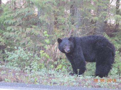 Briefly, the life cycle is as follows: the female digs a hole in the gravel 15 to 20 cm deep to lay her eggs. She digs 3 or four nests, which collectively are called a Redd. As she spawns, a male covers her eggs with milt. This task is completed in August and September, the best time to view the channels. If you are viewing be aware that the dying salmon are an important food source for the local bears! During the winter months the eggs turnto alevin then to fry. As we walked up the channel Common Merganser, Bonaparte's Gull, Greater Yellowlegs, Belted Kingfisher and Herring Gull were all enjoying the emerging fry. In spring the fry descend to Babine Lake to feed on zooplankton for one to two years. Then as smolt they swim down the Skeena to the Pacific. Briefly, the life cycle is as follows: the female digs a hole in the gravel 15 to 20 cm deep to lay her eggs. She digs 3 or four nests, which collectively are called a Redd. As she spawns, a male covers her eggs with milt. This task is completed in August and September, the best time to view the channels. If you are viewing be aware that the dying salmon are an important food source for the local bears! During the winter months the eggs turnto alevin then to fry. As we walked up the channel Common Merganser, Bonaparte's Gull, Greater Yellowlegs, Belted Kingfisher and Herring Gull were all enjoying the emerging fry. In spring the fry descend to Babine Lake to feed on zooplankton for one to two years. Then as smolt they swim down the Skeena to the Pacific.
 The return of the salmon to their spawning beds is one of nature's most important heart beats in the BC. At the end of the five- or six-year life-cycle, the adult fish die.Some of their carcasses wash into the lake and provide nutrients for microscopic plant cells, which in turn feed the zooplankton. In the rivers and creeks the fish provide food for bears, eagles, wolves and many other animals. The remains fertilize trees and other plants. The rings on tree stumps show which years were good salmon runs in the past. The return of the salmon to their spawning beds is one of nature's most important heart beats in the BC. At the end of the five- or six-year life-cycle, the adult fish die.Some of their carcasses wash into the lake and provide nutrients for microscopic plant cells, which in turn feed the zooplankton. In the rivers and creeks the fish provide food for bears, eagles, wolves and many other animals. The remains fertilize trees and other plants. The rings on tree stumps show which years were good salmon runs in the past.
Further along the lake we found a campsite at Red Bluff Provincial Park in Babine Nation territory. It is named for the iron stained cliffs which plunge almost vertically into the lake. In 1971 "the Mammoth of Babine Lake" was excavated. The partial skeleton of a Columbian Mammoth dates back about 34,000 years. The unlucky animal appears to have got stuck in a pond. These mammoths were larger than their Woolly Mammoth cousins. They measured about 4 m. high, weighed about 10 tonnes and their tusks were about 4 m. long! Their diet consisted of grasses, sedge and some woody plants. At the time of its death this area was a shrubby tundra environment. These mammoths ranged as far south as Costa Rica before they became extinct about 13,000 years ago. 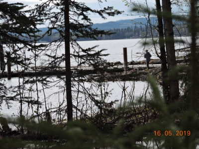 Granisle is a sleepy village with good access for boaters to Babine Lake. It has a friendly welcoming disposition which in part can be measured by its picnic tables, available to all. The road soon changes to a good gravel surface and winds over the Babine range. In mid May there was still a little snow on the north facing slopes. Following Babine Lake Road passed scenic Tanglechain and Doris Lakes, a side road took us to the Chapman Lake Recreation Area for a short break. Our next stop was at the Cronin Trail head in Babine Mountain Provincial Park. Snow covered the nearby mountain slopes. As the road descended the mountain the valley opened up where the Telkwa flows into the Bulkley River. We were soon back at Hwy 16 and the end of the Granisle loop. Granisle is a sleepy village with good access for boaters to Babine Lake. It has a friendly welcoming disposition which in part can be measured by its picnic tables, available to all. The road soon changes to a good gravel surface and winds over the Babine range. In mid May there was still a little snow on the north facing slopes. Following Babine Lake Road passed scenic Tanglechain and Doris Lakes, a side road took us to the Chapman Lake Recreation Area for a short break. Our next stop was at the Cronin Trail head in Babine Mountain Provincial Park. Snow covered the nearby mountain slopes. As the road descended the mountain the valley opened up where the Telkwa flows into the Bulkley River. We were soon back at Hwy 16 and the end of the Granisle loop.
For more info see our article on page 3 of the BC Nature's Winter 2021 - Vol. 59 No. 4 |